
Southern California Water Report: Week of October 17, 2026
Short version: here's how the water off Southern California was setting up this week, from a satellite composite a few days old and the latest NOAA buoy readings. It's a general read, not a forecast. Water moves every day, so check the live chart before you run.
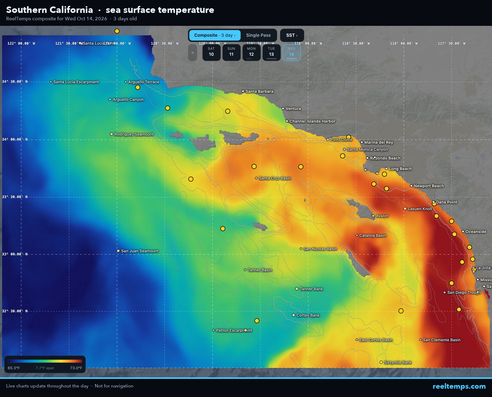
The water this week
- Satellite range: most of the area read about 66 to 72°F, with a middle of about 69°F.
- Warmest water: The biggest patch of 72°F-plus water is centered about 25 nm W of Mission Bay.
- Sharpest break: The sharpest edge we can see runs about 60 nm WNW of Santa Barbara: roughly 65°F to 67°F inside about 3 nm.
Satellite and in water readings can differ, and edges move with wind and current, so confirm on the day you go.
Buoys right now
Right now, 24 NOAA buoys in the area read 68 to 75°F.
- Santa Monica Basin (NDBC 46025): 72°F
- Tanner Bank (NDBC 46047): 68°F
- East Santa Barbara (NDBC 46053): 70°F
All the buoys, with wind and waves, are on our free Southern California water temps page.
What to look for
Find the temperature edge closest to your range, then check whether a color change and some structure line up with it. Our guide to reading a temperature break walks through it, and the Southern California chart guide covers the local structure.
The demo is the full product on real satellite data. Then unlock every region for $99.99/yr.
Not for navigation.
The demo is the full product on real satellite data. Then unlock every region for $99.99/yr.
Not for navigation. ReelTemps is a fishing intelligence tool. We show data, not catch guarantees.