
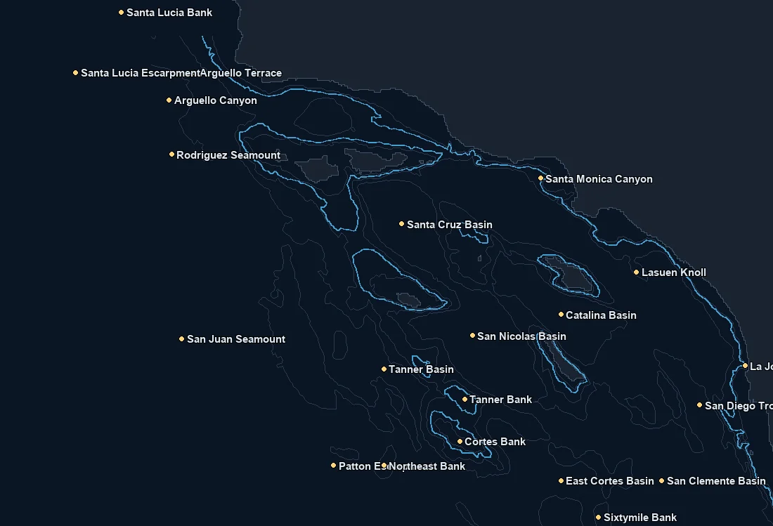
Named spots
| Spot | Type | Depth | From nearest port |
|---|---|---|---|
| Arguello Canyon | canyon | 819 fm | – |
| Arguello Terrace | feature | 363 fm | – |
| Catalina Basin | feature | 687 fm | – |
| Cortes Bank | bank | 32 fm | – |
| East Cortes Basin | feature | 891 fm | – |
| La Jolla Canyon | canyon | 67 fm | – |
| Lasuen Knoll | bank | 84 fm | – |
| Northeast Bank | bank | 230 fm | – |
| Patton Escarpment | feature | 1185 fm | – |
| Rodriguez Seamount | bank | 364 fm | – |
| San Clemente Basin | feature | 1030 fm | – |
| San Diego Trough | canyon | 626 fm | – |
| San Juan Seamount | bank | 365 fm | – |
| San Nicolas Basin | feature | 980 fm | – |
| Santa Cruz Basin | feature | 1050 fm | – |
| Santa Lucia Bank | bank | 260 fm | – |
Nearby buoys
2026-10-19 12:50 UTC · NOAA NDBC 46011
2026-10-19 12:50 UTC · NOAA NDBC 46025
2026-10-19 12:40 UTC · NOAA NDBC 46047
2026-10-19 12:50 UTC · NOAA NDBC 46053
2026-10-19 12:50 UTC · NOAA NDBC 46054
2026-10-19 12:50 UTC · NOAA NDBC 46069
Latest NOAA NDBC observations. Satellite and in water readings may differ.
Fishing Southern California
Southern California fishes warmer and bluer than the coasts to the north, and the chart reflects that. From Point Conception down through the Southern California Bight to San Diego, you are working a basin of islands, banks and deep channels where warmer offshore water, eddies and current edges do most of the work. The hunt here is less about a hard cold upwelling seam and more about finding the temperature breaks, the color changes and the warm water that pushes up from the south, often marked by cleaner blue water meeting greener or cooler water.
Structure is everywhere in the Bight. The offshore banks like the ridges and high spots scattered through the channel, the island edges around the Channel Islands, and the deep drop offs all concentrate bait when the current sets up on them. Named high spots and banks are classic targets because a temperature or color edge sitting over that structure is where the pelagics hunt. Pairing the SST and chlorophyll layers with the depth contours is how you find the spot where the warm water, the edge and the bottom all line up.
Seasonally this is a warm water pelagic fishery when the conditions push in. Bluefin tuna have become a major target in recent years, yellowtail work the banks and islands, and in warmer years yellowfin tuna and dorado move up from the south. Calico bass, rockfish and other bottomfish anchor the nearshore and island fishing through their seasons. None of it is promised. Warm water years and cold water years look very different, and seasons and regulations change, so always check current rules.
The move is to watch where the warm blue water and the breaks are setting up relative to the banks and islands, and to run to the edge that has the temperature, the color and the structure all working together rather than chasing warm water with no edge to it.
What you get with ReelTemps
- Sea surface temperatureFind the temperature break
- Chlorophyll-aSpot the green-to-blue color seam
- Composite & single passBlended picture or the freshest overpass
- CompareTemperature and color side by side
- Depth readoutFathoms and feet on hover, tap or mark
- Currents & buoysSee the water move and ground-truth it
- Route, ruler & waypointsPlan the run and save your spots
From the water
I've tried every temp map out there and they all feel like they were built ten years ago. I'm not exactly a tech guy, but this one actually makes sense the second you open it. First time using it, I marked a break in about 30 seconds the night before and boated bluefin right on it the next morning.
Used to burn half a tank driving around looking for color change or a solid temp break. Now I check ReelTemps before I leave the dock and I know exactly where I'm going. Less time driving around guessing, more time with lines in the water.
Albacore season used to mean a couple hours of homework the night before and just hoping it held up. Now I do most of my research that morning and pull it up on my phone if things change once we're out there. Makes calling an audible a lot easier.