
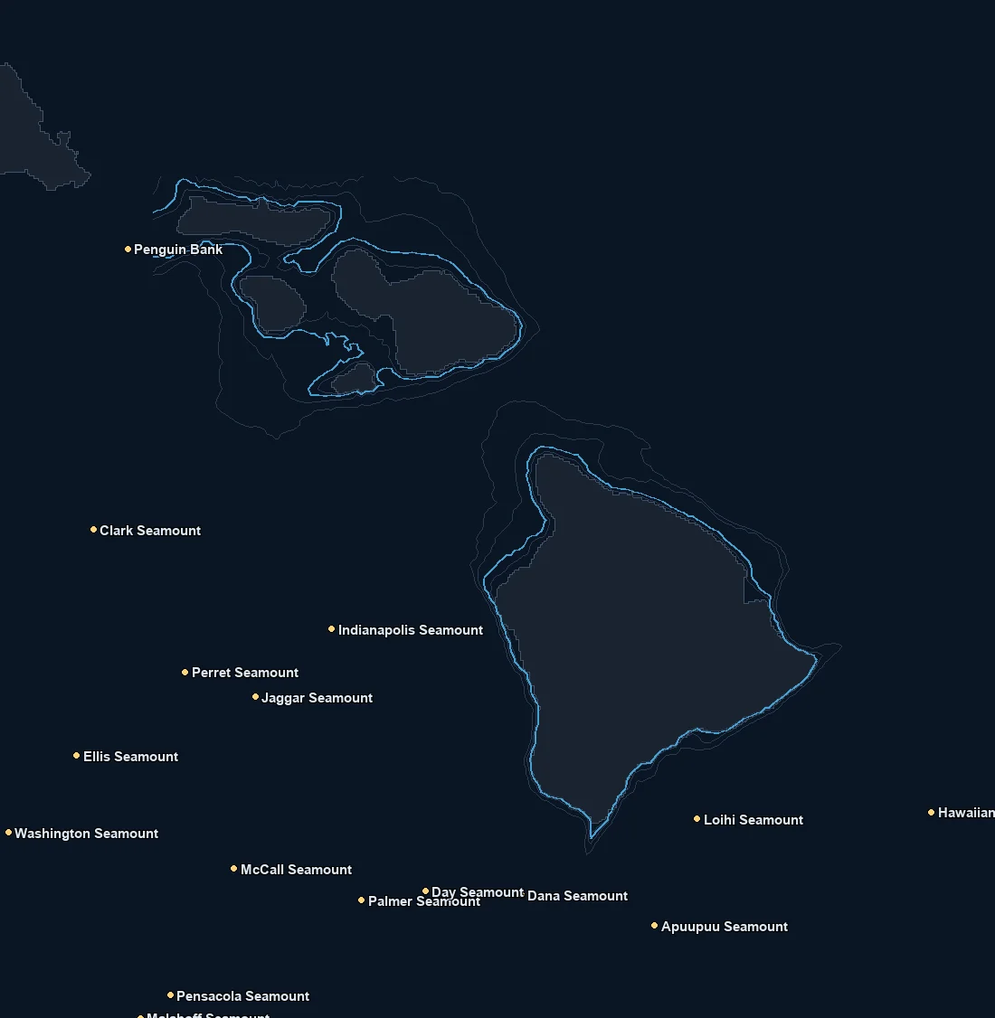
Named spots
| Spot | Type | Depth | From nearest port |
|---|---|---|---|
| Apuupuu Seamount | bank | 1019 fm | – |
| Clark Seamount | bank | 2126 fm | – |
| Dana Seamount | bank | 1157 fm | – |
| Day Seamount | bank | 1343 fm | – |
| Ellis Seamount | bank | 1052 fm | – |
| Hawaiian Trough | canyon | 2985 fm | – |
| Indianapolis Seamount | bank | 1927 fm | – |
| Jaggar Seamount | bank | 1167 fm | – |
| Loihi Seamount | bank | 622 fm | – |
| Malahoff Seamount | bank | – | – |
| McCall Seamount | bank | 831 fm | – |
| Palmer Seamount | bank | 1722 fm | – |
| Penguin Bank | bank | 33 fm | – |
| Pensacola Seamount | bank | 502 fm | – |
| Perret Seamount | bank | 1255 fm | – |
| Washington Seamount | bank | 748 fm | – |
Nearby buoys
2026-10-19 10:56 UTC · NOAA NDBC 51201
2026-10-19 10:56 UTC · NOAA NDBC 51202
2026-10-13 18:56 UTC · NOAA NDBC 51205
2026-10-19 10:56 UTC · NOAA NDBC 51206
2026-10-19 11:00 UTC · NOAA NDBC 51211
2026-10-19 11:00 UTC · NOAA NDBC 51212
Latest NOAA NDBC observations. Satellite and in water readings may differ.
Fishing Maui / Big Island
Maui and the Big Island fish deep, warm, blue Pacific water with some of the most dramatic underwater relief anywhere, and the chart is built for that. There is no continental shelf here. The islands rise steeply from very deep water, so the drop offs and the deep water are close to shore, and the hunt is about temperature breaks, color changes and current edges in warm tropical water rather than a cold upwelling seam. The channels between the islands, especially the strong current that funnels through them, and the eddies that wrap around the islands set up the edges where bait and pelagics gather.
Structure and current work together here. The steep drop offs right off the islands, the offshore banks and seamounts, and the famous deep ledges where the bottom falls away fast all concentrate bait when the current sets up on them. The channels between the islands accelerate the current and can set up strong, persistent edges. Floating debris and current lines offshore hold bait as well. A temperature or color edge sitting over a bank, a ledge or a seamount is far more productive than the same seam over open, deep water, which is why the SST and chlorophyll layers belong on the screen with the depth contours.
Seasonally this is a warm water pelagic fishery close to year round, with the makeup shifting through the year. Several tuna species, dorado, known locally as mahimahi, wahoo, called ono here, and billfish including marlin are among the species anglers target when the conditions line up. The Big Island in particular has a long billfish tradition. The runs and the mix change year to year with the water. Nothing is guaranteed, and seasons and regulations change, so always check current rules.
Before you run, read where the warm water edges are sitting, line them up against the channels, the banks and the island drop offs, and point the bow at the edge that has the temperature, the color and the structure all working together.
What you get with ReelTemps
- Sea surface temperatureFind the temperature break
- Chlorophyll-aSpot the green-to-blue color seam
- Composite & single passBlended picture or the freshest overpass
- CompareTemperature and color side by side
- Depth readoutFathoms and feet on hover, tap or mark
- Currents & buoysSee the water move and ground-truth it
- Route, ruler & waypointsPlan the run and save your spots
From the water
I've tried every temp map out there and they all feel like they were built ten years ago. I'm not exactly a tech guy, but this one actually makes sense the second you open it. First time using it, I marked a break in about 30 seconds the night before and boated bluefin right on it the next morning.
Used to burn half a tank driving around looking for color change or a solid temp break. Now I check ReelTemps before I leave the dock and I know exactly where I'm going. Less time driving around guessing, more time with lines in the water.
Albacore season used to mean a couple hours of homework the night before and just hoping it held up. Now I do most of my research that morning and pull it up on my phone if things change once we're out there. Makes calling an audible a lot easier.