
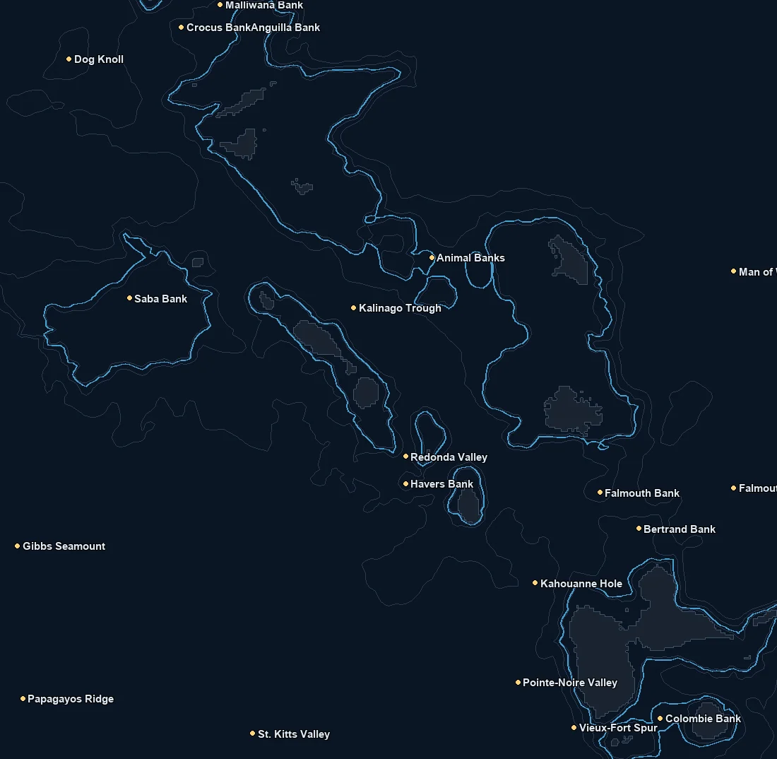
Named spots
| Spot | Type | Depth | From nearest port |
|---|---|---|---|
| Amonhana Valley | canyon | 481 fm | – |
| Anegada Gap | canyon | – | – |
| Anguilla Bank | bank | 31 fm | – |
| Anguillita Spur | feature | 284 fm | – |
| Animal Banks | bank | 39 fm | – |
| Antigua Valley | canyon | 1837 fm | – |
| Basse-Terre Spur | feature | – | – |
| Bertrand Bank | bank | 36 fm | – |
| Colombie Bank | bank | 41 fm | – |
| Crocus Bank | bank | 28 fm | – |
| Dog Knoll | bank | 245 fm | – |
| Falmouth Bank | bank | 58 fm | – |
| Falmouth Valley | canyon | 1341 fm | – |
| Gibbs Seamount | bank | 98 fm | – |
| Havers Bank | bank | 93 fm | – |
| Kahouanne Hole | feature | 648 fm | – |
Nearby buoys
2026-10-19 06:50 UTC · NOAA NDBC 42060
Latest NOAA NDBC observations. Satellite and in water readings may differ.
Fishing Leeward Islands
The Leeward Islands fish as steep drop, blue water country, and the chart is built to read that edge. Off St Martin, St Kitts, Antigua and Guadeloupe the bottom falls away into deep Atlantic and Caribbean water very close to shore, so you do not run far to reach the grounds that matter. The work is finding where warm water, current seams and color changes stack up near that dropoff and in the channels between the islands.
Treat the chart as intelligence, not a guarantee. Layer the pieces together. A clean SST break where warmer blue meets slightly cooler or greener water, a chlorophyll color change that marks a bait line, and the depth structure of the wall or the passes between islands. Where those line up, bait concentrates and wahoo, tuna and billfish tend to follow. FAD fishing is common here, and the same reading of breaks and edges helps you decide which FADs and seams are worth the fuel.
The headline species are wahoo, blue and white marlin, yellowfin and blackfin tuna, and mahi, often called dorado. Wahoo hold tight to the dropoff and the current edges, tuna and mahi roam the color changes and FADs, and marlin work the deeper blue water offshore. Hunt the seams between islands where current accelerates and pushes bait against structure.
Seasons, runs and regulations change every year, so check current local rules and closures before you go. This is a planning tool and it is not for navigation. Satellite SST and chlorophyll point you toward water that has looked right lately, but the ocean moves daily, so treat the chart as a starting hypothesis and let what you see on the water make the final call.
What you get with ReelTemps
- Sea surface temperatureFind the temperature break
- Chlorophyll-aSpot the green-to-blue color seam
- Composite & single passBlended picture or the freshest overpass
- CompareTemperature and color side by side
- Depth readoutFathoms and feet on hover, tap or mark
- Currents & buoysSee the water move and ground-truth it
- Route, ruler & waypointsPlan the run and save your spots
From the water
I've tried every temp map out there and they all feel like they were built ten years ago. I'm not exactly a tech guy, but this one actually makes sense the second you open it. First time using it, I marked a break in about 30 seconds the night before and boated bluefin right on it the next morning.
Used to burn half a tank driving around looking for color change or a solid temp break. Now I check ReelTemps before I leave the dock and I know exactly where I'm going. Less time driving around guessing, more time with lines in the water.
Albacore season used to mean a couple hours of homework the night before and just hoping it held up. Now I do most of my research that morning and pull it up on my phone if things change once we're out there. Makes calling an audible a lot easier.